
Parcel 21-2S-23-0000-0003-0000
Owners
DUBE MARY T
3402 CR 121
BALDWIN, FL 32009
Parcel Summary
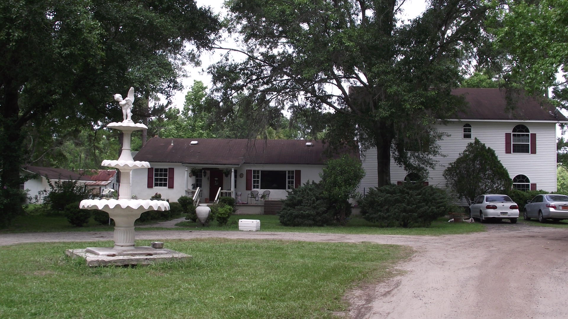
| Situs Address | 3402 CR 121 |
|---|---|
| Use Code | 0100: SINGLE FAMILY |
| Tax District | 6: Drainage Dist |
| Acreage | 14.4700 |
| Section | 21 |
| Township | 2S |
| Range | 23 |
| Subdivision | |
| Exemptions | None |
Short Legal
N1/2 OF NE1/4 OF NW1/4 &OR 173/591 & OR 682/815
PARCELS 3 & 3-1...
Certified Values
| STANDARD | 2024 |
|---|---|
| Land Value | $217,050 |
| (+) Improved Value | $377,300 |
| (=) Market Value | $594,350 |
| (-) Agricultural Classification | $0 |
| (=) Assessed Value | $500,030 |
| (=) County Taxable Value | $500,030 |
Document/Transfer/Sales History
| Instrument / Official Record | Date | Q/U | V/I | Sale Price | Ownership |
|---|---|---|---|---|---|
| QC 2359/1614 | 2020-05-07 | U | Improved | $100 | Grantor: STEWART MARK MARION Grantee: STEWART MATTHEW THOMAS |
| FJ 2356/0974 | 2020-04-20 | U | Improved | $0 | Grantor: STEWART MADGE D EST Grantee: DUBE MARY T & MATTHEW T STEWART ET AL |
| WD 0173/0591 | 1974-01-01 | Q | Improved | $40,000 | |
| TA 0082/0598 | 1968-01-01 | U | Improved | $12,000 |
Buildings
Building # 1, Section # 1, 101938, RESIDENTIAL
| Heated Sq Ft | Year Built | Value |
|---|---|---|
| 1421 | 1950 | $104,946 |
Structural Elements
| Type | Description | Code | Details |
|---|---|---|---|
| EW | Exterior Wall | 16 | WD FR STUC |
| RS | Roof Structure | 03 | GABLE/HIP |
| RC | Roof Cover | 03 | COMP SHNGL |
| IW | Interior Wall | 05 | DRYWALL |
| IF | Interior Flooring | 14 | CARPET |
| IF | Interior Flooring | 05 | ASPH TILE |
| AC | Air Conditioning | 03 | CENTRAL |
| HT | Heating Type | 04 | AIR DUCTED |
| BDR | Bedrooms | 3.00 | |
| BTH | Bathrooms | 1.00 | |
| FR | Frame | 02 | WOOD FRAME |
| CW | Common Wall | 19.00 | |
| STR | Stories | 1. | 1. |
| BUD8 | BUD8 Adjustment | 06 | DIST 1D |
Building # 2, Section # 1, 249723, RESIDENTIAL
| Heated Sq Ft | Year Built | Value |
|---|---|---|
| 2268 | 2001 | $260,765 |
Structural Elements
Extra Features
| Code | Description | Length | Width | Units | Unit Price | AYB | % Good Condition | Final Value |
|---|---|---|---|---|---|---|---|---|
| 0510 | GARAGE WD-MTL | 24 | 48 | 1152.00 | $35.00 | 1973 | 20% | $8,064 |
| 0845 | KOOL DECK | 1431.00 | $7.25 | 1973 | 23% | $2,386 | ||
| 0511 | GARAGE CB-BRICK | 13 | 27 | 351.00 | $35.20 | 1973 | 23% | $2,842 |
| 0510 | GARAGE WD-MTL | 48 | 18 | 864.00 | $35.00 | 2001 | 28% | $8,467 |
| 0351 | CARPORT MTL | 18 | 18 | 324.00 | $10.00 | 2000 | 20% | $648 |
| 0504 | FP-ELECTRIC | 1.00 | $2,000.00 | 2001 | 84% | $1,680 | ||
| 0812 | CONCRETE C | 1172.00 | $4.00 | 1998 | 73% | $3,422 |
Land Lines
Personal Property
None
TRIM Notices
Property Record Cards
Disclaimer
The Nassau County Property Appraiser's Office makes every effort to produce the most accurate information possible. No warranties, expressed or implied, are provided for the data herein, its use or interpretation. The information contained herein is for ad valorem tax assessment purposes only. The Property Appraiser exercises strict auditing procedures to ensure validity of any transaction received and posted by this office but cannot be responsible for errors or omissions in the information received from external sources. Due to the elapsed time between transactions in the marketplace, and the time that those transactions are received from the public and/or other jurisdictions, some transactions will not be reflected.